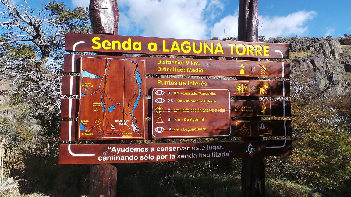
LAGUNA TORRE
A few meters from the De Agostini camp (named in commemoration of Father Alberto Maria De Agostini), is the Cerro Torre lagoon, another of the most popular tours in the area.
Currently there are 2 starting points, both are within the village and end up joining in a few minutes:
During the whole route the trail is perfectly signposted and since it is one of the busiest, it is very likely that we will come across many people.
After a little more than 2 km (1.2 mi), we will find the first panoramic point: Cerro Torre viewpoint. From this point we already have a perspective of the immensity of Cerro Torre, Cerro Grande and the entire mountain range that accompanies them.
The trail continues through a very quiet valley and approximately at kilometer 5.5 (3.4 mi) we find the fork of the “Laguna Madre e Hija” trail (trail that connects the Poincenot camp with the De Agostini camp – more info: Laguna de los Tres – Laguna Torre Traverse). Also at this point we will have access to a latrine.
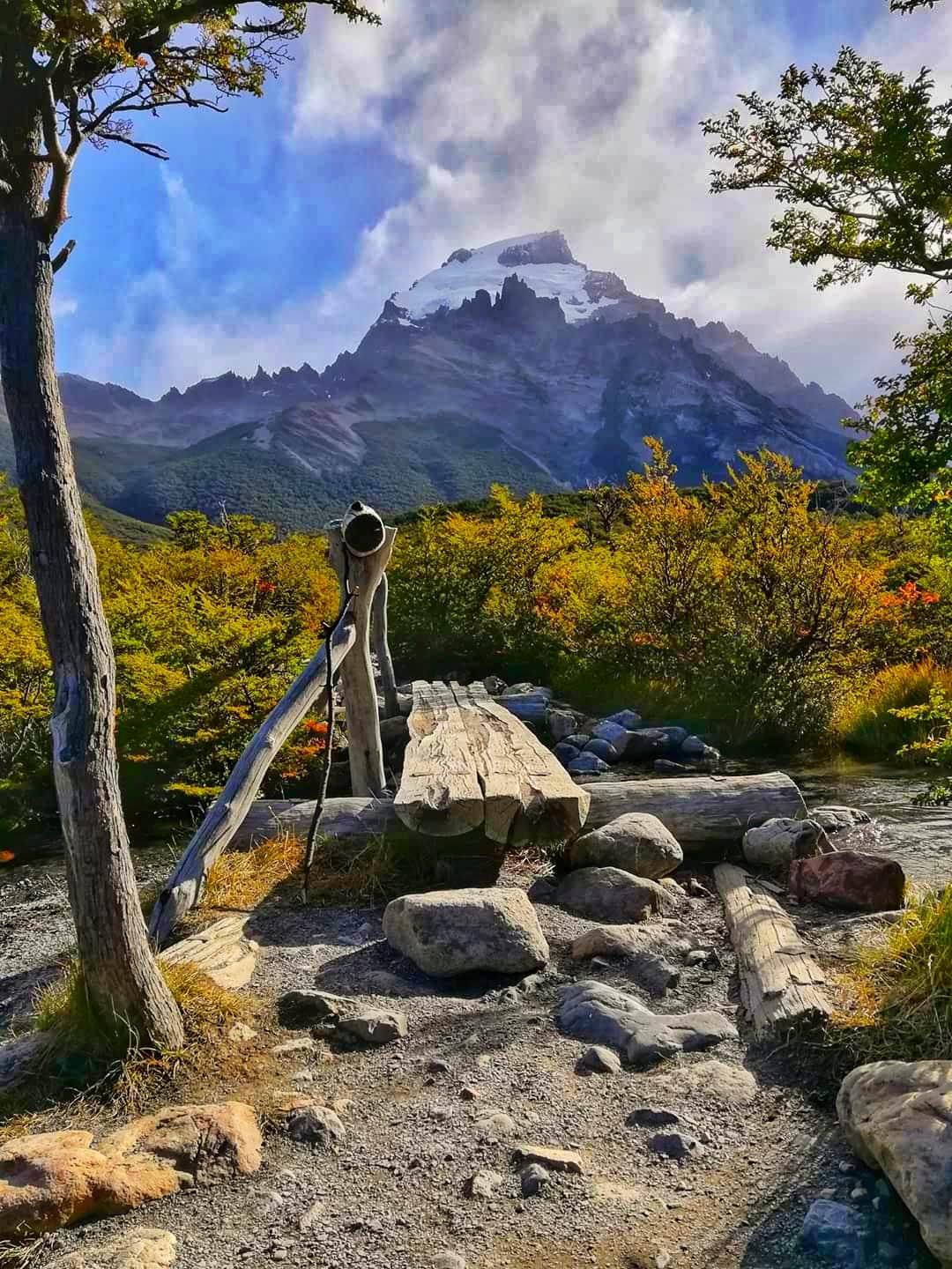
A few meters before reaching Laguna Torre, there is a detour to De Agostini camp (ideal to spend the night and wait for the sunrise).
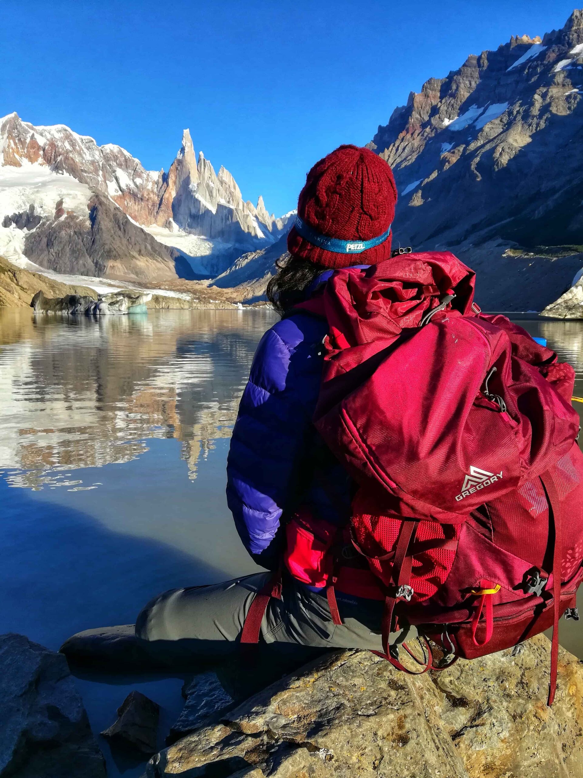
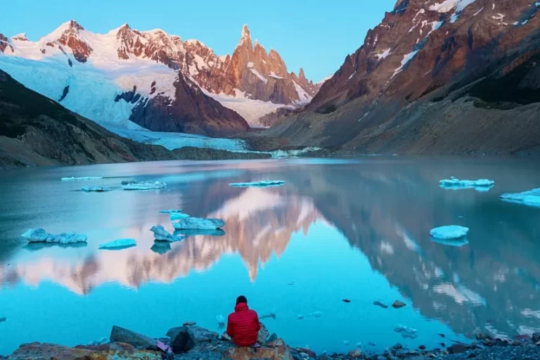
Once we reach the shore, it is time to rest and enjoy the views. You must have something to eat and a camera or cell phone for the pictures!
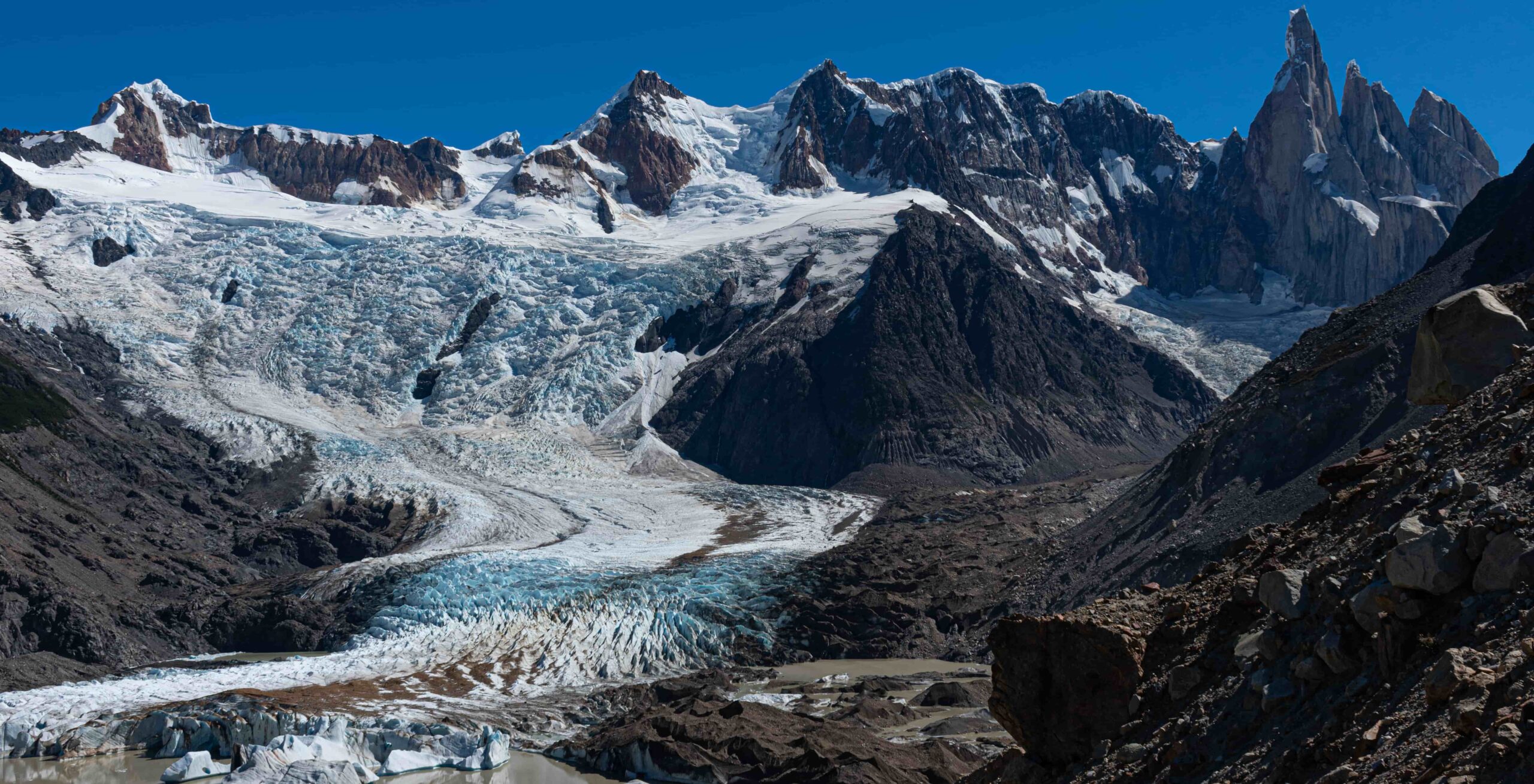
Additionally (and if the weather allows), it is possible to continue bordering the lagoon until you reach the Maestri viewpoint to get a better view.
Total distance (round trip): Approximately 18 km / 11.1 mi.
Estimated time (round trip): It depends on the physical conditions of each person, but we estimate 7:00 / 8:00 hs in total.
Time: Full day tour. It is suggested to start early in the morning to take advantage of the maximum amount of daylight hours.
See: Recommended weather Apps.
Before starting any trail, it is recommended to check the weather conditions. Additionally (and depending on the time of year and the type of the hike), it is recommended to check the time of sunrise and sunset.
We recommend the use of the following Apps (or their corresponding desktop version):
- WINDY.COM: Very useful to corroborate wind speed and gusts.
- YR.NO: With this app we will be able to check the temperature and precipitation.
For more info about the weather and alternative Apps: click here.
MAP AND TRACK DOWNLOAD
🎯 Important: We don’t offer mountain guiding services, but we have contact with local guides. In case you need this service, let us know!
Important: Use this track as a reference, it may contain errors. We recommend always be guided by the official signage and if in doubt, please contact the staff of Los Glaciares National Park.
PHOTOS AND VIDEOS