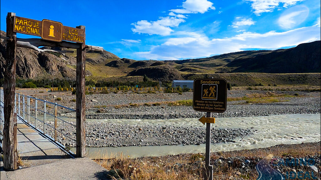
DE LOS CÓNDORES AND THE LAS ÁGUILAS VIEWPOINT

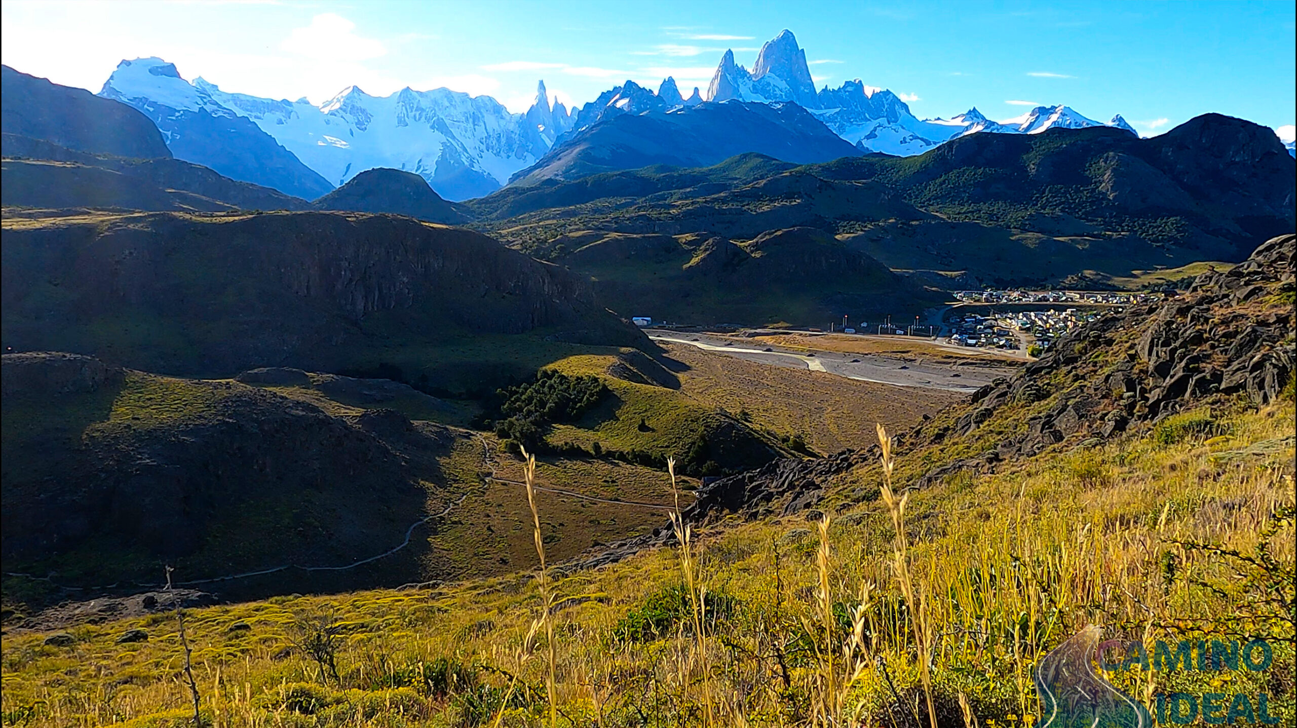
One of the most accessible alternatives to do with the family. A few kilometers from the town and on the same trail, we will have access to spectacular views of the entire valley, both of the town and Lake Viedma.
The main route starts at the park ranger’s hut, east of El Chaltén. At the fork we take the road to the left and begin to ascend progressively to the first of the viewpoints: Mirador de los cóndores.
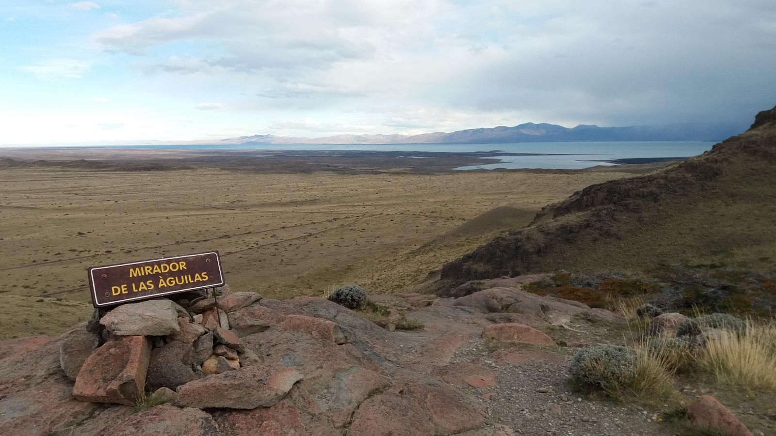
To access the Mirador de las Águilas we will only have to return to the previous fork and take the path on the left, which will guide us to one of the most beautiful views of the valley, with Lake Viedma in the background.
And as their names suggest, if we are lucky we may spot eagles or Andean condors in the area.
Total distance (round trip): Approximately 5 km / 3.1 mi.
Estimated time (round trip): It depends on the physical conditions of each person, but we estimate about 2:00 / 3:00 hs in total.
Time: Full day tour. It is suggested to start early in the morning to take advantage of the maximum amount of daylight hours.
See: Recommended weather Apps.
Before starting any trail, it is recommended to check the weather conditions. Additionally (and depending on the time of year and the type of the hike), it is recommended to check the time of sunrise and sunset.
We recommend the use of the following Apps (or their corresponding desktop version):
- WINDY.COM: Very useful to corroborate wind speed and gusts.
- YR.NO: With this app we will be able to check the temperature and precipitation.
For more info about the weather and alternative Apps: click here.
MAP AND TRACK DOWNLOAD
🎯 Extras: This map in GPX and KML format is in the “Mapas” folder of the free Google Drive. To enter directly: click here.
Important: Use this track as a reference, it may contain errors. We recommend always be guided by the official signage and if in doubt, please contact the staff of Los Glaciares National Park.
PHOTOS AND VIDEOS