

An unmissable journey for all those who enjoy multi-day routes and breathtaking landscapes. 4 intense days where you will travel through pampas, streams, rivers and glaciers up to 1500 meters above sea level to appreciate the immensity of the Southern Patagonian Ice Field.
Important: This hike takes place in an area of Los Glaciares National Park that is considered a “Remote Area“, so it is essential to have some mountain experience to do it. The trails are not signposted as in the case of the treks that are part of the backbone network (Laguna de los Tres, Laguna Torre, etc.), nor is there medical assistance nearby or campsites with amenities.
Use the described information only as a reference, and before starting it is recommended to go to the “Cerferino Fonzo” Visitor Center to obtain updated information about the route and the necessary equipment.
Registration of Mountain Use in Remote Areas – Los Glaciares National Park:
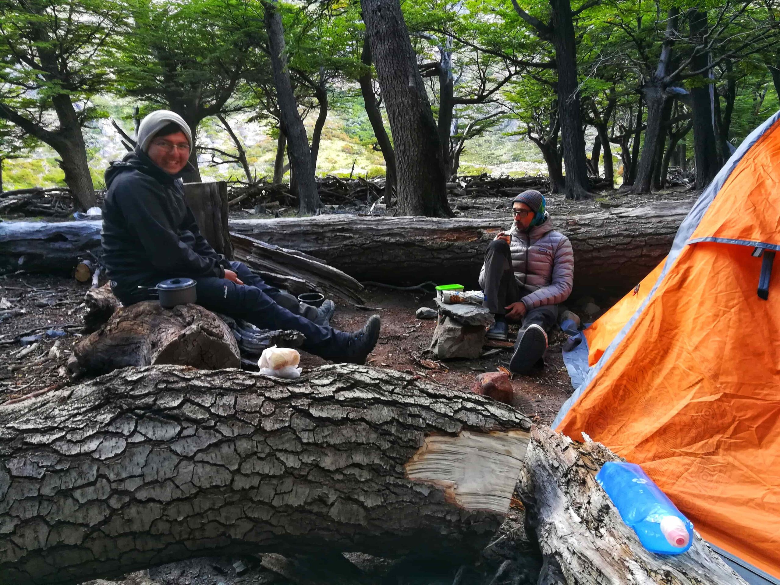
Day 1: El Chaltén – Camp. Toro
Total distance: 17 km / 10.5 mi.
Walking time: 6 hs approx.
Elevation gain: 250 mts.
Overnight stay: Toro Camp.
Leaving from the town, we take the path towards Toro Lake. All along the way there are beautiful views of Lake Viedma and you cross some streams (which may have small log bridges to cross them), always in the direction of the Rio Túnel Valley.
Without many difficulties, you reach the first camp.
Day 2: Camp. Toro – Refugio Paso del viento
Total distance: 14 km / 8.6 mi.
Walking time: 8 – 9 hs approx.
Difference in altitude: 900 mts.
Overnight stay: Camp / Refugio Paso del viento.
Intense and long day.
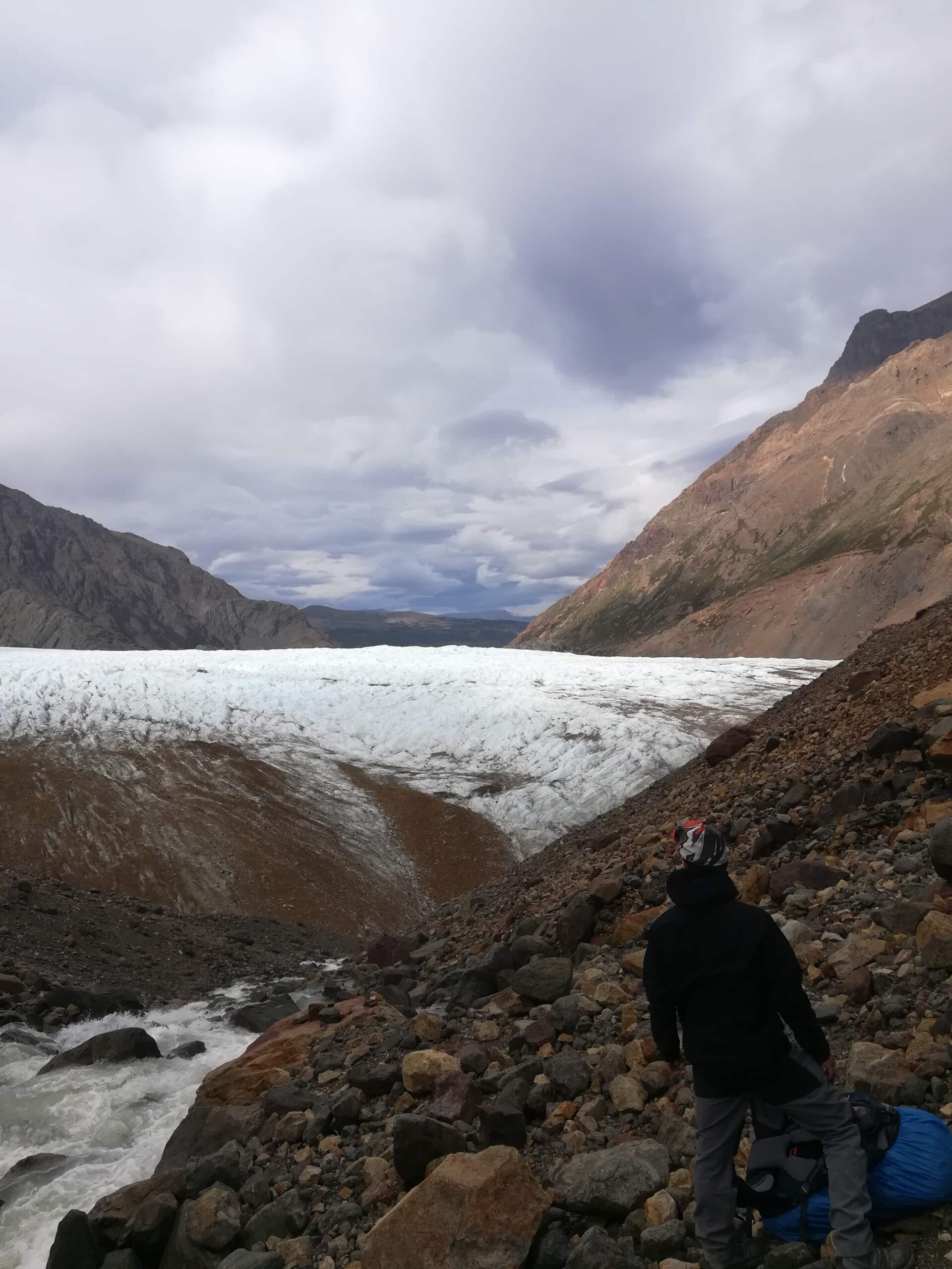
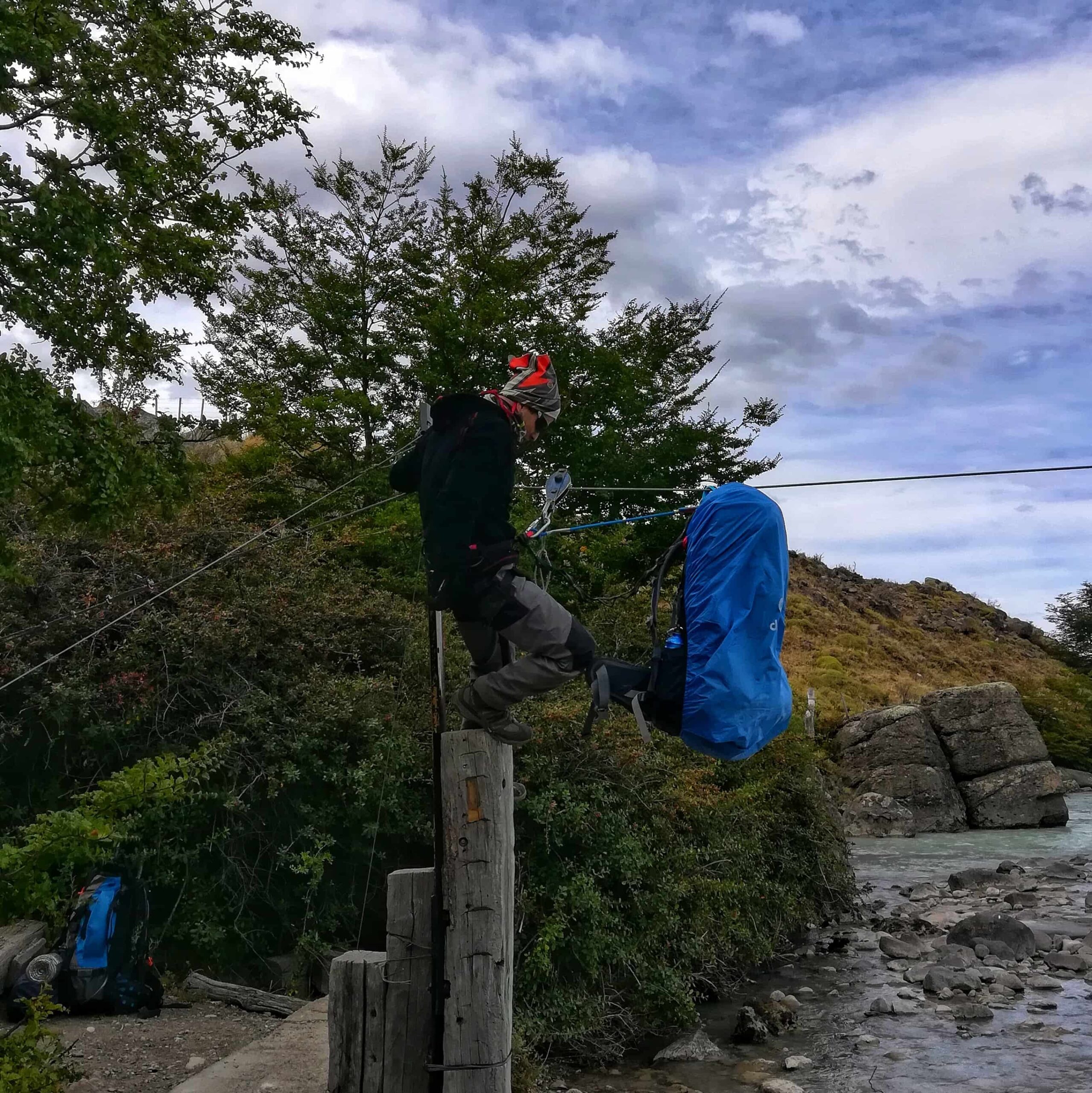
Leaving the camp on the right side, the ascent begins and we cross the Túnel River using the zipline that is installed. Then we continue the march in the direction of the glacier Túnel Inferior.
Important: Area with a lot of landslides and possibly without a visible trail. It is recommended to leave the carriage that borders the glacier and continue advancing along the glacier without getting too deep (it is not necessary to use crampons). Descend from the glacier and follow the monoliths upstream.
Once upstream, on the left bank you can see a bivouac and the path that begins to ascend towards Paso del Viento.
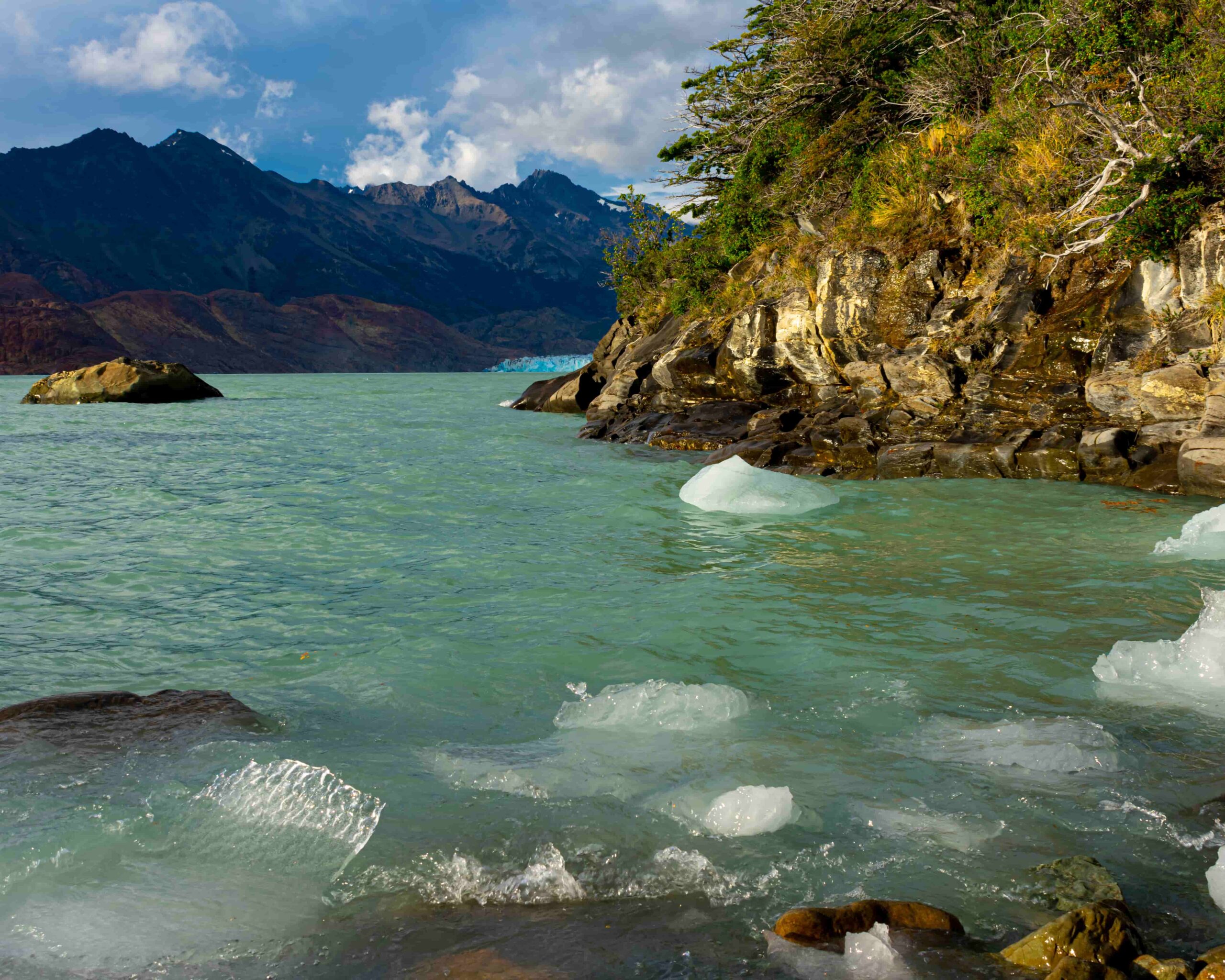
From this point you have a spectacular view of the Patagonian ice field.
The descent is done following the path to the left until you arrive at the Paso del Viento Refuge.
Day 3: Refugio Paso del Viento – Camp. Bahía de los Témpanos
Total distance: 17 km / 4.3 mi.
Walking time: 6 – 7 hs approx.
Difference in altitude: 150 mts.
Overnight stay: Bahía Tunel Camp.
Another intense day, although less long than the previous one.
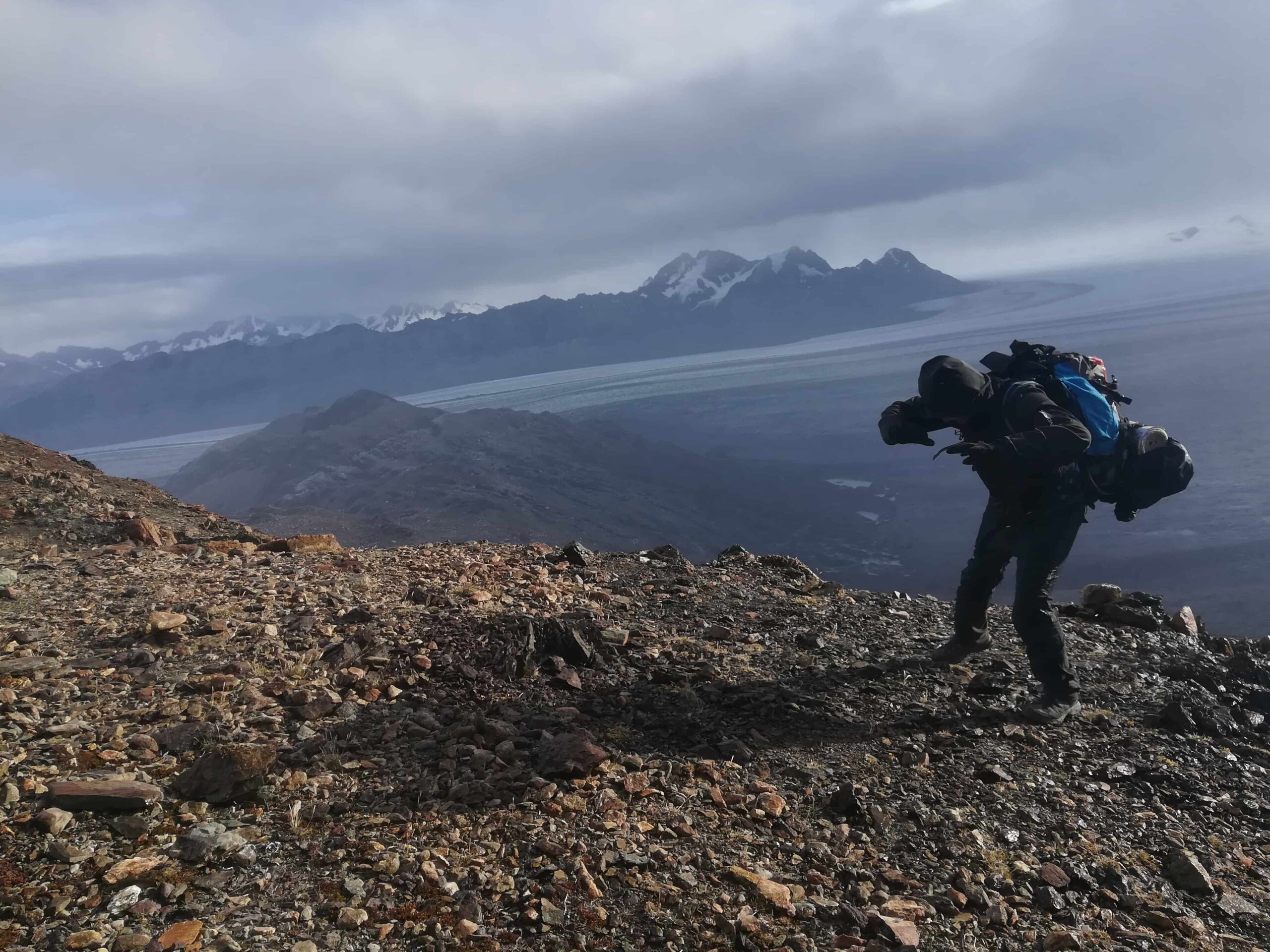
After leaving the camp, we continue southwards always with the Viedma Lake on the right and start the ascent to the Huemul Pass, from this point we can appreciate the immensity of the ice field.
Important: The descent to Bahía de los Témpanos is very steep, caution is recommended to avoid accidents.
Finally you arrive at Bahía de los Témpanos from where you can see the beginning of the Viedma Glacier.
Day 4: Camp. Bahía de los Témpanos – El Chaltén
Total distance: 18 km / 11.1 mi (up to B. Túnel) / 24 km / 14.9 mi (up to El Chaltén)
Walking time: 6 hs (to B. Túnel) / 8 hs (to El Chaltén) approx.
Unevenness: 50 mts.
Overnight stay: El Chaltén.
Last day of the trek. It is mostly through a steppe with lots of vegetation and after 4/5 hours we cross the Túnel River again with the zip line. Finally 2 hours later we arrive at the Estancia Río Túnel.
From here there are several alternatives to get to the town and it depends mainly on the time of the year:
Total distance: 70 km / 43.5 mi (complete circuit).
Total estimated time: 4 days and 3 nights.
See: Equipment for long trekking or hiking
See: What to pack for hiking in Patagonia?
For the crossing of the zip lines it is necessary to have:
In addition, it is necessary to have:
It goes without saying that it is necessary to have knowledge and experience in the use of these materials. It is recommended not to improvise on the fly to avoid accidents.
About the crossing:
About the environment:
Before starting any trail, it is recommended to check the weather conditions. Additionally (and depending on the time of year and the type of the hike), it is recommended to check the time of sunrise and sunset.
We recommend the use of the following Apps (or their corresponding desktop version):
For more info about the weather and alternative Apps: click here.
🎯 Extras: This map in GPX and KML format is in the “Mapas” folder of the free Google Drive. To enter directly: click here.
Important: Use this track as a reference, it may contain errors. We recommend always be guided by the official signage and if in doubt, please contact the staff of Los Glaciares National Park.

TrekkingElChalten.com started as a project born from a group of friends passion for the mountains. Here you will learn about all the different activities you can partake in El Chaltén, the hiking capital of Argentina.
Designed by StreetSud – Servicios Digitales in Patagonia Argentina |
Copyright © 2024 | Trekking El Chalten
This trail or crossing is located within the Remote Area of Los Glaciares National Park, so it is essential that you and your group have sufficient experience in mountain activities and are able to face and solve any kind of inconvenience that may arise during the entire journey.
We recommend that before starting the tour, you go to the Ceferino Fonzo Visitors Center (open daily from 9 am to 5 pm) to check the status of the trails, the necessary equipment and any extra information that may be useful.