

Possibly the most popular crossing in the area. In 3 days and 2 nights the 2 main points are joined: Laguna de los Tres and Laguna Torre.
Important: This trek departs from the village and returns to the village, there is also the possibility of starting it directly from Puente del Río Eléctrico.
Day 1: El Chaltén – Laguna de los Tres – Camp. Poincenot
Total distance: 14 km / 8.6 mi.
Walking time: 7 hs approx.
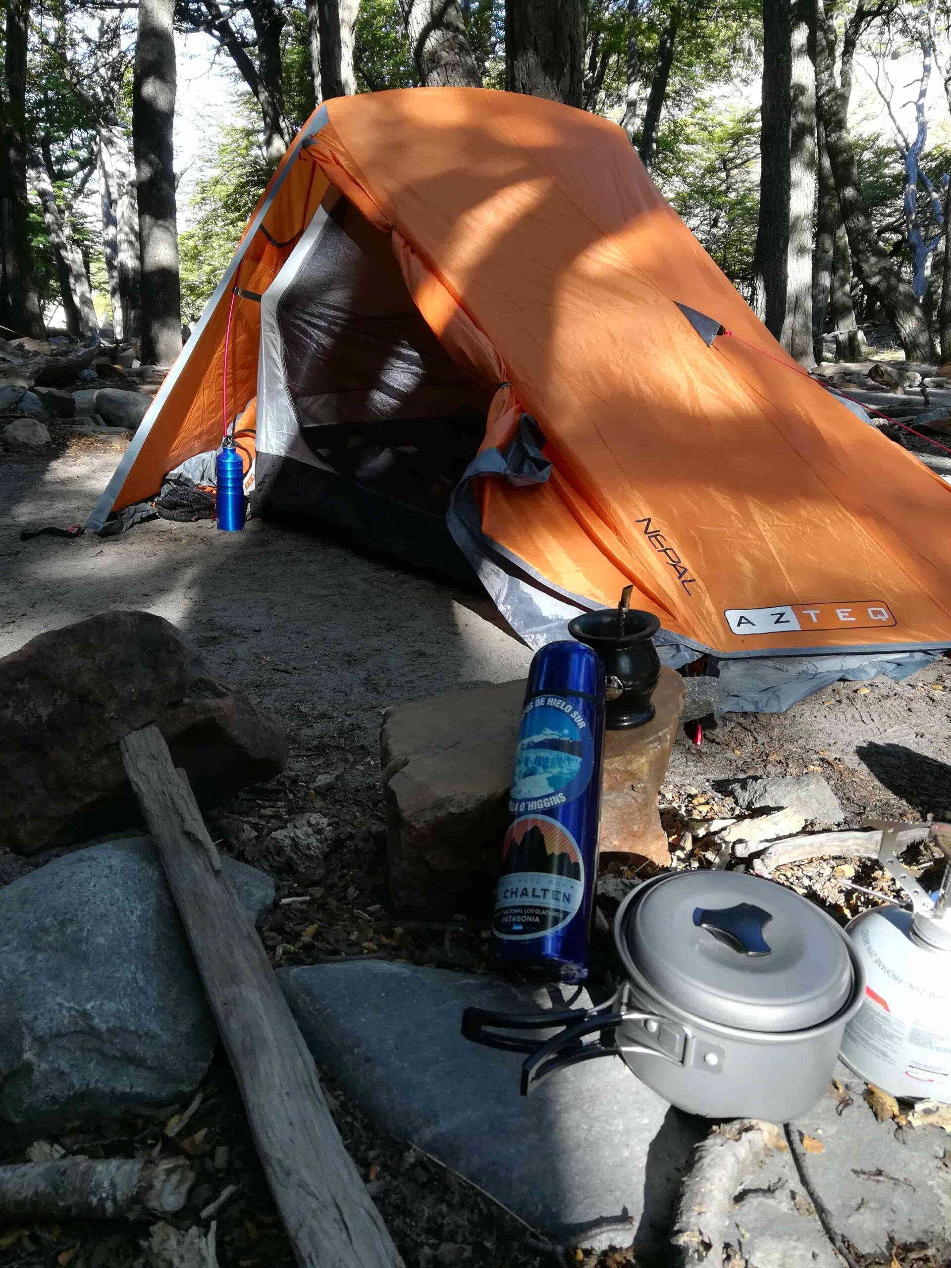
Overnight: Poincenot Camp.
The route begins at the end of San Martin Avenue, at the north end of the town and the beginning is perfectly signposted with signs of Los Glaciares National Park.
Little by little, the route begins to ascend for approximately 3 kilometers until we find a fork, where we will be able to:
A) Visit Laguna Capri, where in turn it is possible to spend the night and make use of the latrines (Left).
B) Visit the Fitz Roy viewpoint (Right).
In either case, the trail rejoins later on.
Approximately at km 7 (4.3 mi) we reach another fork: Crossing the road Madre e Hija, which joins with the trail to Laguna Torre (We will return to this point tomorrow), turn right and soon we will arrive at the Poincenot camp.
After setting up the tent, eating something and resting for a while, we cross the bridge and start the final part of the trip (the famous “final climb”): Laguna de los Tres.
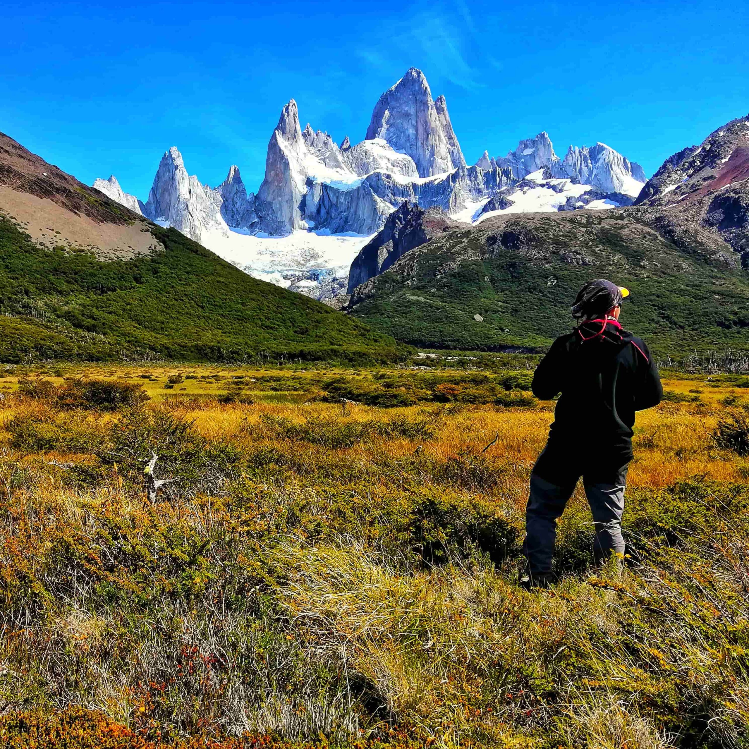
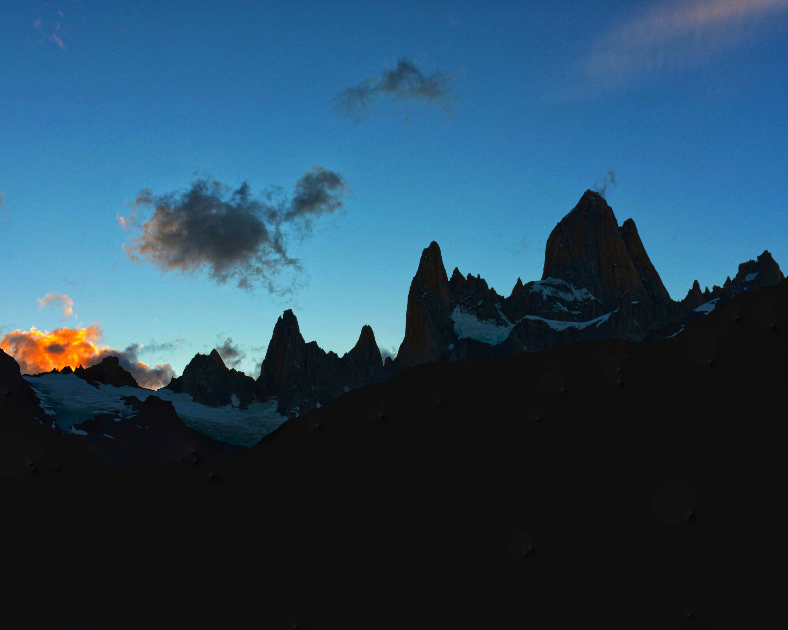
Depending on our physical condition and fatigue, this climb will take us between 1 and 2 hours. But every effort is worth it. Soon we will be enjoying the turquoise colors of the lagoon and the mythical Cerro Fitz Roy (Chaltén) in the background.
Tip: If the weather is good, we recommend making the last effort to see the sunrise from the lagoon. Keep in mind the time of sunrise (see “Recommendations” tab) and leave Poincenot about 2 or 2:30 hours before sunrise to go without rushing.
Day 2: Camp. Poincenot – Mother and Daughter – Laguna Torre – Camp. D’Agostini
Total distance: 14 km / 8.6 mi.
Walking time: 5 hs approx.
Overnight stay: D’Agostini Camp.
After a good breakfast, we retrace our steps to the fork that will connect us with the trail to Laguna Torre (Laguna Madre and Hija trail).
We will walk for approximately 3 hours with views of the Laguna Madre (larger lagoon) and the Laguna Hija (smaller).
Tip: Those in the know say that it is also possible to visit the Nieta Lagoon, to complete “the whole family“.
The road is practically level, and there are different internal trails to the shores of both lagoons, ideal to rest a little and appreciate the landscape that we are leaving behind.
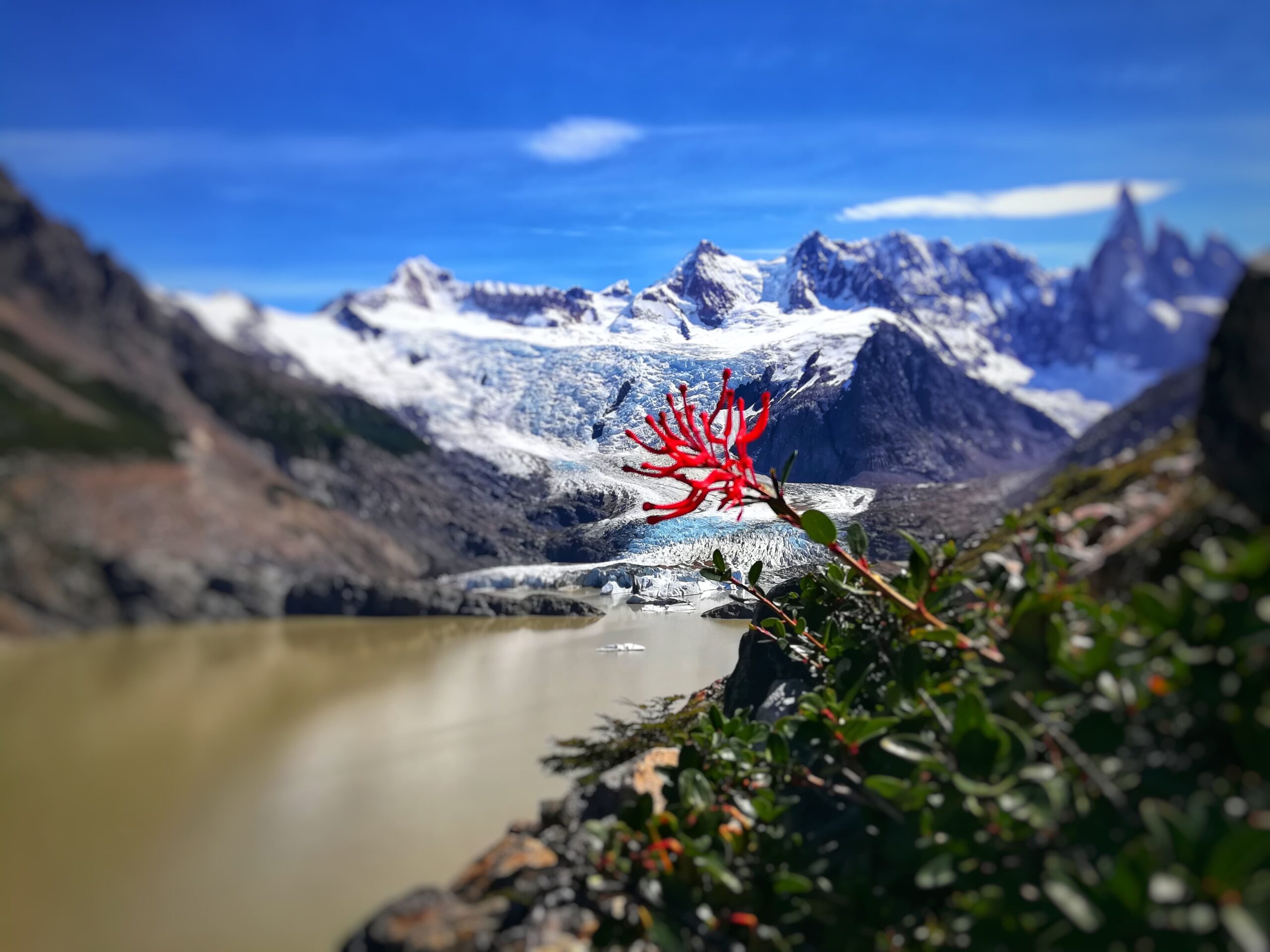
Once we make the connection with the trail to Laguna Torre, we turn towards the D’Agostini camp to set up the tent and continue a few more minutes towards the shore of Lake Torre.
In addition, we will be able to continue bordering the lake and have a better view from the Mirador Maestri.
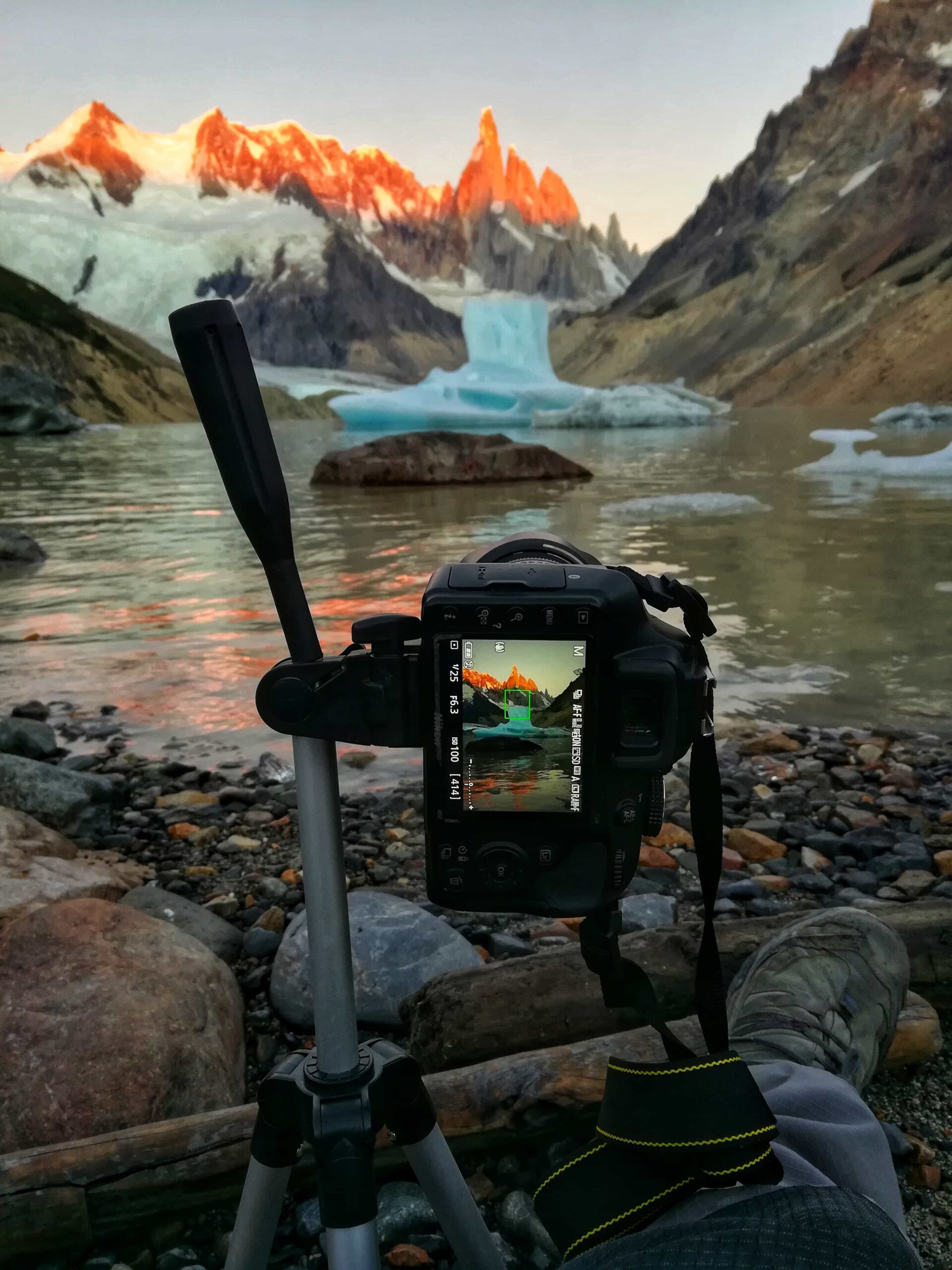
Tip 2: Same as the previous day, it is highly recommended to wait for sunrise at the lake. For this take into account: time of sunrise and forecast (especially clouds – the tower is quite capricious and you can not always see well).
Leaving from D’Agostini about 30 minutes before sunrise is enough.
Day 3: Camp. D’Agostini – El Chaltén
Total distance: 8 km / 4.9 mi.
Walking time: 3 – 4 hs approx.
Overnight: El Chaltén.
Unfortunately, this is the last day of the trip. Considering that the trek will only take about 3 or 4 hours, we can take advantage of the day to go to Laguna Torre again or settle down for some mates in the surroundings.
On the way back we can stay a while at the Cerro Torre Viewpoint, which is also very nice.
Tip: On the way back to town it is almost mandatory to have a good pint of beer to celebrate ;).
Total distance: 36 km / 22.3 mi (complete circuit).
Total estimated time: 3 days and 2 nights.
About the crossing:
About the environment:
Before starting any trail, it is recommended to check the weather conditions. Additionally (and depending on the time of year and the type of the hike), it is recommended to check the time of sunrise and sunset.
We recommend the use of the following Apps (or their corresponding desktop version):
For more info about the weather and alternative Apps: click here.
🎯 Extras: This map in GPX and KML format is in the “Mapas” folder of the free Google Drive. To enter directly: click here.
Important: Use this track as a reference, it may contain errors. We recommend always be guided by the official signage and if in doubt, please contact the staff of Los Glaciares National Park.
TrekkingElChalten.com started as a project born from a group of friends passion for the mountains. Here you will learn about all the different activities you can partake in El Chaltén, the hiking capital of Argentina.
Designed by StreetSud – Servicios Digitales in Patagonia Argentina |
Copyright © 2024 | Trekking El Chalten