
A hidden gem in Patagonia is Laguna de los Tres. It’s the most sought after hike of El Chaltén. The beauty is well worth the journey!
Important: This route begins and ends in the village, it is also possible to do the Puente del Río Eléctrico – Laguna de los Tres – Village route, where you can view the imposing Piedras Blancas Glacier.
The route starts at the end of San Martin Avenue, at the north end of the town and the beginning is perfectly signposted with signs of Los Glaciares National Park.
Gradually, the route begins to ascend for approximately 3 kilometers (1.8 mi) until it reaches a fork, where we will be able to:
A) Visit Laguna Capri and spend the night at its campsite (Left).
B) Visit the Fitz Roy viewpoint (Right).
In either case, the trail continues later on.
Approximately at km 7 (4.3 mi) we’ll reach another fork: Crossing of the Madre e Hija trail, which joins with the trail to Laguna Torre (More info: Laguna de los Tres – Laguna Torre).
Following the signs, we turn right to cross a bridge and finally reach Poincenot Camp.
This camp is the ideal place to rest a little and fuel up on food and water. There is also a latrine available if necessary.
Once we recharge, we cross the bridge and begin to walk the famous “final climb“. For a little more than 1 km (0.7 mi), we will walk over rocks and loose stones that are on a steep slope (It is recommended to check the weather for exposure to wind).
Spoiler Alert: Yes, this is the most difficult part of the route. It is recommended to do this last stretch, without rushing and resting plenty along the way and making sure to stay hydrated and keeping the body fueled.
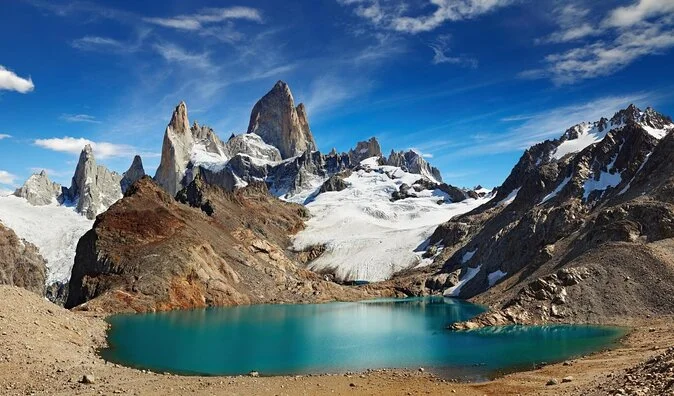
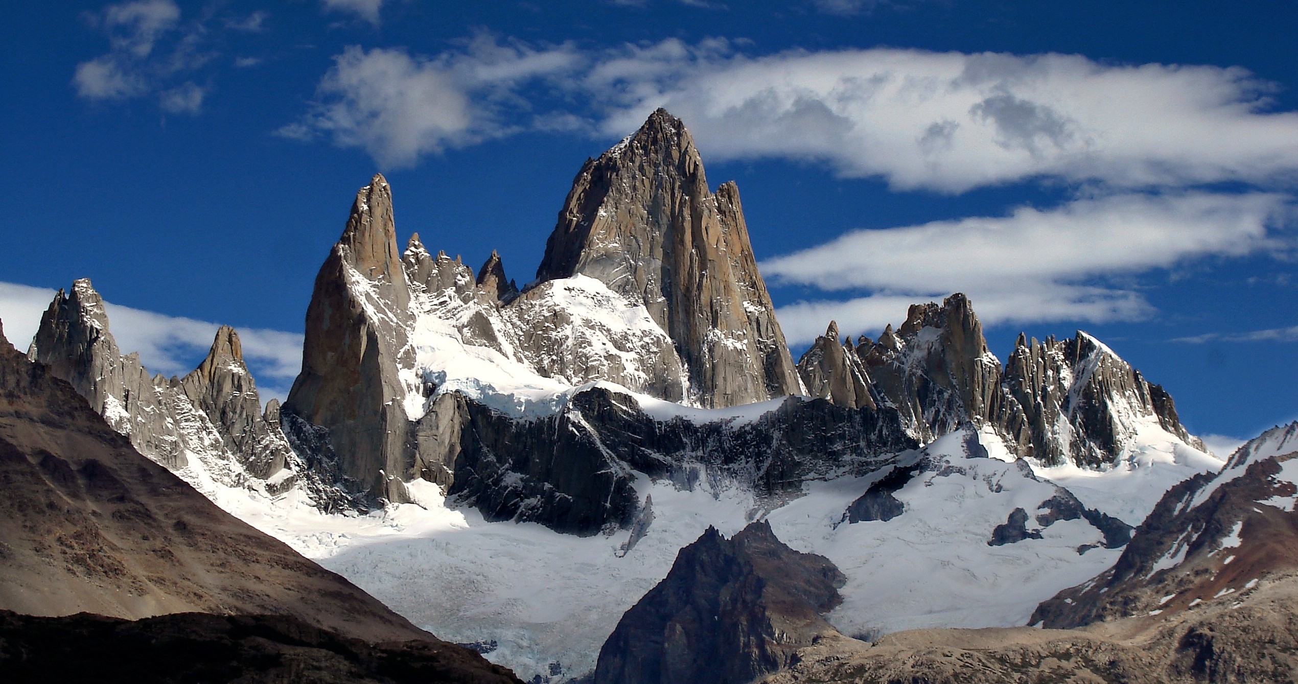
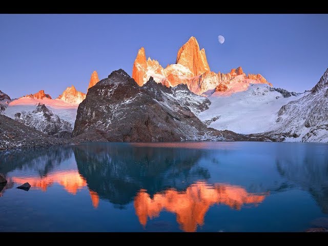
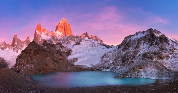
After this last effort we finally reach the magical place that everyone wants to visit: “Laguna de los Tres” where we can see a turquoise lagoon and the mythical Cerro Chalten (or Mount Fitz Roy) in the background.
After reaching the destination, make sure to rest and admire the beauty that Patagonia Argentina has to offer!
Total distance (round trip): Approximately 21 km / 13 mi.
Estimated time (round trip): It depends on the physical conditions of each person, but we estimate 8:00 / 9:00 hs in total.
Time: Full day tour. It is suggested to start early in the morning to take advantage of the maximum amount of daylight hours.
See: Recommended weather Apps.
Before starting any trail, it is recommended to check the weather conditions. Additionally (and depending on the time of year and the type of the hike), it is recommended to check the time of sunrise and sunset.
We recommend the use of the following Apps (or their corresponding desktop version):
For more info about the weather and alternative Apps: click here.
🎯 Extras: This map in GPX and KML format is in the “Mapas” folder of the free Google Drive. To enter directly: click here.
Important: Use this track as a reference, it may contain errors. We recommend always be guided by the official signage and if in doubt, please contact the staff of Los Glaciares National Park.

TrekkingElChalten.com started as a project born from a group of friends passion for the mountains. Here you will learn about all the different activities you can partake in El Chaltén, the hiking capital of Argentina.
Designed by StreetSud – Servicios Digitales in Patagonia Argentina |
Copyright © 2024 | Trekking El Chalten